
Explore New Mexico
Find your next stop, from white dunes to ancient canyon dwellings.
No places found
Try a park or a nearby town, such as White Sands or Los Alamos.
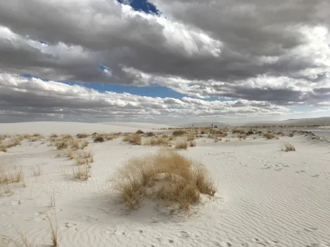 OutdoorsWhite SandsAlamogordo
Hiroooooo · Commons · CC BY-SA 4.0

National Park
World's largest gypsum dunefield.
Read the park guide- Entrance
- $25 per vehicle, 7 days
- Before you go
- None, but missile-test closures
- Map location
- White Sands Visitor Center
Enter from US 70 between mile markers 199 and 200. Dunes Drive begins here; check park and highway closures before leaving.
Location source checked .
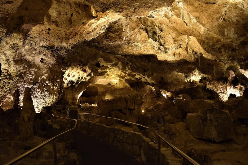 UndergroundCarlsbad CavernsCarlsbad
NPS / Anthony Mazzucco · Commons · Public domain

National Park
Massive limestone show cave.
Read the park guide- Entrance
- $15 per person age 16 and up, 3 days
- Before you go
- Timed entry required, $1 via Recreation.gov
- Map location
- Carlsbad Caverns Visitor Center
Follow the seven-mile park road from Whites City to the visitor center. Cave entry requires a separate timed reservation.
Location source checked .
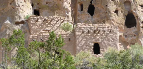 HistoryBandelierLos Alamos
Daniel Mayer (Mav) · Commons · CC BY-SA 3.0

National Monument
Ancestral Pueblo cliff dwellings in Frijoles Canyon.
Official visitor information- Entrance
- $25 per vehicle, cashless
- Before you go
- Intermittent shuttle on selected weekends and holidays, March 19–October 14, 2026; check the schedule
- Map location
- Bandelier Visitor Center, Frijoles Canyon
This is the canyon visitor center. On scheduled shuttle days, parking may be at Frey Trailhead; check the current shuttle and parking instructions.
Location source checked .
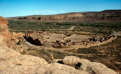 HistoryChaco CultureNageezi
Gerd Eichmann · Commons · CC BY-SA 4.0

National Historical Park
Monumental Ancestral Puebloan great houses.
Official visitor information- Entrance
- $25 per vehicle, cashless
- Before you go
- None; rough dirt-road approach
- Map location
- Chaco Culture Visitor Center
Follow NPS approach instructions: GPS can suggest unsafe or private roads. The recommended northern approach includes 13 miles of rough dirt road.
Location source checked .
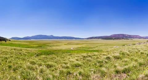 OutdoorsValles CalderaJemez Springs
Thomas Shahan · Commons · CC BY 2.0

National Preserve
Vast grassland volcanic caldera.
Official visitor information- Entrance
- $25 per vehicle, cashless
- Before you go
- Backcountry driving pass May 15 to November 15
- Map location
- Volcano Discovery Center, Valles Caldera
Visitor services are in the Cabin District, four miles along the main entrance road from NM 4. Driving beyond the Cabin District requires a backcountry vehicle pass.
Location source checked .
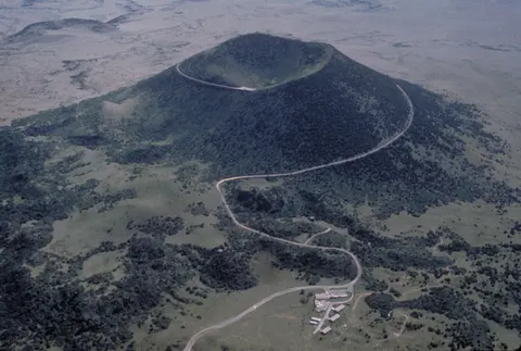 OutdoorsCapulin VolcanoCapulin
NPS staff · Commons · Public domain

National Monument
Drivable extinct cinder cone with rim trail.
Official visitor information- Entrance
- $20 per vehicle, cashless
- Before you go
- None
- Map location
- Capulin Volcano Visitor Center
The entrance is three miles north of Capulin on NM 325. Stop at the visitor center before driving Volcano Road to the rim.
Location source checked .
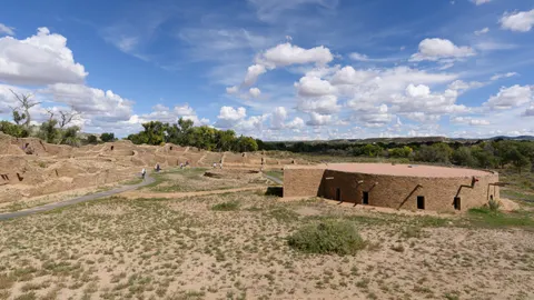 HistoryAztec RuinsAztec
King of Hearts · Commons · CC BY-SA 4.0

National Monument
Great house ruins and a reconstructed great kiva.
Official visitor information- Entrance
- Free
- Before you go
- None
- Map location
- Aztec Ruins Visitor Center
Start at the visitor center at 725 Ruins Road in Aztec for the museum and the West Ruins walking route.
Location source checked .
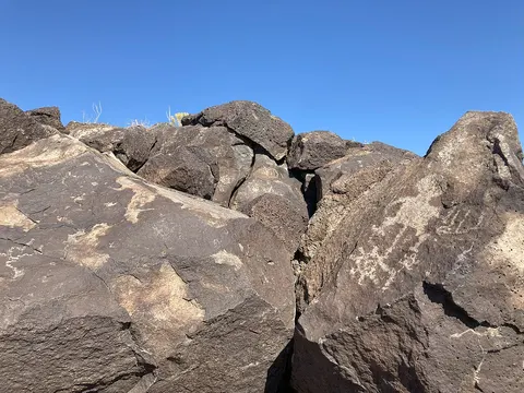 HistoryPetroglyphAlbuquerque
SunnyintheSouthwest · Commons · CC BY-SA 4.0

National Monument
About 24,000 petroglyphs on a volcanic escarpment.
Official visitor information- Entrance
- Free entrance
- Before you go
- None
- Map location
- Petroglyph Visitor Information Center · multi-site park
Start at 6510 Western Trail NW for orientation. No petroglyph-viewing trails start here; the canyon trailheads require separate drives.
Location source checked .
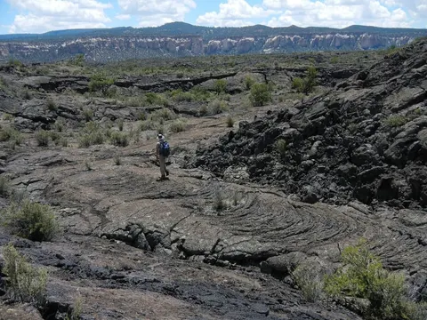 OutdoorsEl MalpaisGrants
NPS / Justin Peinado · Commons · Public domain

National Monument
Lava flows, lava tubes and sandstone bluffs.
Official visitor information- Entrance
- Free
- Before you go
- Free in-person cave permit required; lava tube caves close November 1–April 30
- Map location
- El Malpais Visitor Center, Grants · multi-site park
The visitor center is at I-40 exit 85 in Grants. Lava trails, overlooks and cave access are separate stops reached from NM 53 or NM 117.
Location source checked .
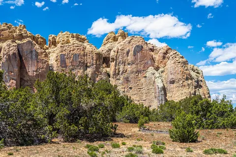 HistoryEl MorroRamah
dconvertini · Commons · CC BY-SA 2.0

National Monument
Inscription Rock: centuries of carved signatures at a desert waterhole.
Official visitor information- Entrance
- Free
- Before you go
- None
- Map location
- El Morro Visitor Center
Enter from NM 53 between mile markers 44 and 45. The Inscription and Headland trails begin at the visitor center; check trail hours before arrival.
Location source checked .
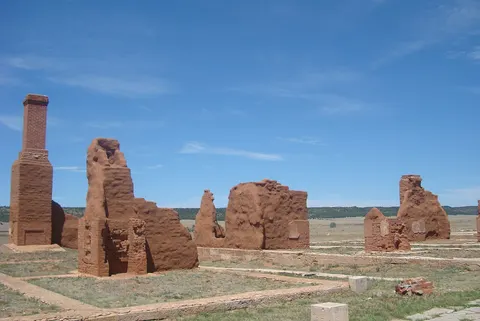 HistoryFort UnionWatrous
Eric T Gunther · Commons · CC BY 3.0

National Monument
Largest 19th-century frontier fort ruins on the Santa Fe Trail.
Official visitor information- Entrance
- Free
- Before you go
- None
- Map location
- Fort Union Visitor Center
Follow NM 161 for eight miles from I-25 exit 366 at Watrous to the monument and visitor center.
Location source checked .
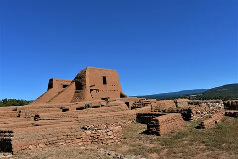 HistoryPecosPecos
Letice Rugula · Commons · CC BY-SA 4.0

National Historical Park
Pueblo and Spanish mission ruins plus the Glorieta Pass battlefield.
Official visitor information- Entrance
- Free
- Before you go
- None
- Map location
- Pecos Visitor Center
Use the main park entrance at 1 Peach Drive for the pueblo and mission trail. The Glorieta Battlefield trailhead is a separate drive.
Location source checked .
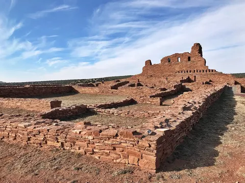 HistorySalinas Pueblo MissionsMountainair
MLMarkel · Commons · CC BY-SA 4.0

National Monument
Three sites of pueblo and mission ruins.
Official visitor information- Entrance
- Free
- Before you go
- None
- Map location
- Mountainair Visitor Center · three-site park
The headquarters visitor center at 105 South Ripley Avenue provides orientation. Abó, Quarai and Gran Quivira are three separate sites reached by car.
Location source checked .
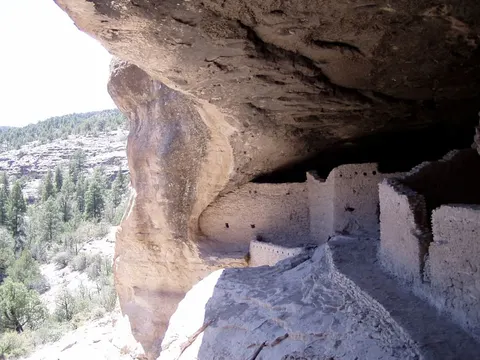 HistoryGila Cliff DwellingsSilver City
Gillfoto · Commons · CC BY-SA 3.0

National Monument
Mogollon cliff dwellings at the edge of the Gila Wilderness.
Official visitor information- Entrance
- Free
- Before you go
- None
- Map location
- Gila Visitor Center
This pin marks the visitor center parking area; the cliff-dwellings trailhead is two miles farther. Follow NPS road guidance, especially for large vehicles.
Location source checked .
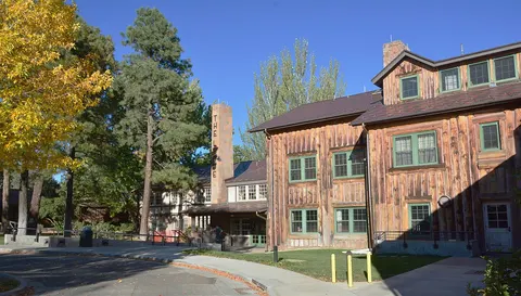 HistoryManhattan Project, Los Alamos unitLos Alamos
Mike McBey · Commons · CC BY 2.0

National Historical Park
Atomic-history sites in Los Alamos.
Official visitor information- Entrance
- Free
- Before you go
- Visitor center and community sites; laboratory access is restricted and tours have separate arrangements
- Map location
- Manhattan Project Visitor Center, Los Alamos
This is the public visitor center in town. Historic laboratory properties have restricted access and are not ordinary drive-up stops.
Location source checked .
Opening New Mexico…
Choose a pin to find your next stop.
Sources & photograph credits
Visitor facts checked September 22, 2026; arrival sources are linked in each place. Fees, access and conditions can change. Photography via Wikimedia Commons; images resized and cropped for this layout.
- White Sands visitor information · Photograph: Hiroooooo · CC BY-SA 4.0
- Carlsbad Caverns visitor information · Photograph: NPS / Anthony Mazzucco · Public domain
- Bandelier visitor information · Photograph: Daniel Mayer (Mav) · CC BY-SA 3.0
- Chaco Culture visitor information · Photograph: Gerd Eichmann · CC BY-SA 4.0
- Valles Caldera visitor information · Photograph: Thomas Shahan · CC BY 2.0
- Capulin Volcano visitor information · Photograph: NPS staff · Public domain
- Aztec Ruins visitor information · Photograph: King of Hearts · CC BY-SA 4.0
- Petroglyph visitor information · Photograph: SunnyintheSouthwest · CC BY-SA 4.0
- El Malpais visitor information · Photograph: NPS / Justin Peinado · Public domain
- El Morro visitor information · Photograph: dconvertini · CC BY-SA 2.0
- Fort Union visitor information · Photograph: Eric T Gunther · CC BY 3.0
- Pecos visitor information · Photograph: Letice Rugula · CC BY-SA 4.0
- Salinas Pueblo Missions visitor information · Photograph: MLMarkel · CC BY-SA 4.0
- Gila Cliff Dwellings visitor information · Photograph: Gillfoto · CC BY-SA 3.0
- Manhattan Project, Los Alamos unit visitor information · Photograph: Mike McBey · CC BY 2.0